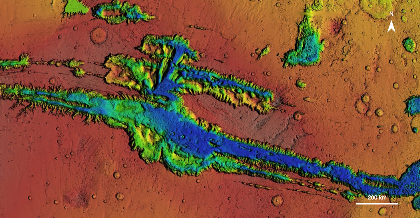
Valles Marineris (VM), the largest canyon system in the Solar System, preserves 3.7 billion years of Martian history. NASA has designated it a Special Region, where terrestrial organisms could potentially replicate, making it a prime target for future missions searching for life. The canyon's unique geology offers critical insights into Martian history and early rocky planet formation. It also contains abundant evidence of past surface water, yet the duration and extent of sustained water, necessary for habitability, remain poorly constrained.
This project aims to quantify surface water availability in VM using two independent hydrologic proxies: landslide mobility, and aridity indices from alluvial fans. Landslide mobility--the ratio of a slide's horizontal to vertical travel distance--reflects flow efficiency, with higher values indicating greater lubrication, most likely from water. The aridity index, a measure of climate dryness, is calculated as the ratio of water input (watershed area) to output (paleolake area) for alluvial fan systems. Tracking variations in these metrics over time allows us to assess trends in VM's hydroclimate and habitability. This study improves on prior work by (i) analyzing a single region (VM) over an extended period to control for spatial climate variations and (ii) integrating two proxies (landslide mobility and aridity index) at the same site to track hydrologic changes independently. The project has two key objectives: Aim 1 is to determine how landslide mobility has evolved, and Aim 2 is to determine how aridity has evolved using alluvial fans.
To address Aim 1, Task 1 involves creating the most comprehensive database of landslides in VM to date (n =1,566), including their mobilities and ages. Landslides have been mapped using a blended High Resolution Stereo Camera (HRSC) -- Mars Orbiter Laser Altimeter (MOLA) digital elevation model coupled with Context Camera (CTX) imagery, all publicly available through the Planetary Data System. Mobility will be calculated from morphology measurements in QGIS, and crater counting will be used to date the landslides, enabling an analysis of mobility trends over time and providing insights into past sediment water content.
For Aim 2, Task 2 will independently assess water availability by calculating aridity indices for alluvial fans using HRSC-MOLA and CTX data. We will expand existing fan inventories through additional mapping, measure each fan's watershed and paleolake areas to calculate aridity indices, and date each fan using crater counting. This will allow us to track aridity trends over time and compare them with landslide mobility trends to build a more complete picture of VM's hydroclimatic history.
This project will significantly advance our understanding of Martian landslides and alluvial fans by refining their morphologies, ages, and metrics related to past water availability. Task 1 will produce the most comprehensive landslide database for VM, increasing the number of mapped slides by 50% and dated slides tenfold. Task 2 will generate the first aridity index dataset for VM alluvial fans, expanding current fan inventories and improving our understanding of these systems. By integrating the two independent hydrologic proxies, this study will reconstruct VM's climate history more deeply. It will offer key insights into how surface water persisted over time and help constrain Mars' transition from a wetter past to its current arid state, contributing to ongoing efforts to reconstruct the planet's climate history. By identifying periods of substantial water availability, this study will help pinpoint key windows of habitability, supporting NASA's Planetary Science objectives to "find and interpret surface records of past climate" and "help ascertain the… evolution of the Solar System and the potential for life elsewhere", while addressing the Decadal Survey question: "Q5.4a Where and How Have Fluvial Processes Sculpted Landscapes?".